File list
From The GenGIS wiki
Jump to navigationJump to searchThis special page shows all uploaded files.
| Date | Name | Thumbnail | Size | User | Description | Versions |
|---|---|---|---|---|---|---|
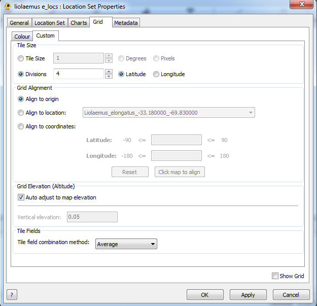
| 10:17, 29 November 2013 | GriddingCustom.png (file) |  |
42 KB | Alex | 1 | |
| 10:17, 29 November 2013 | Locationmerge.png (file) |  |
16 KB | Alex | 1 | |
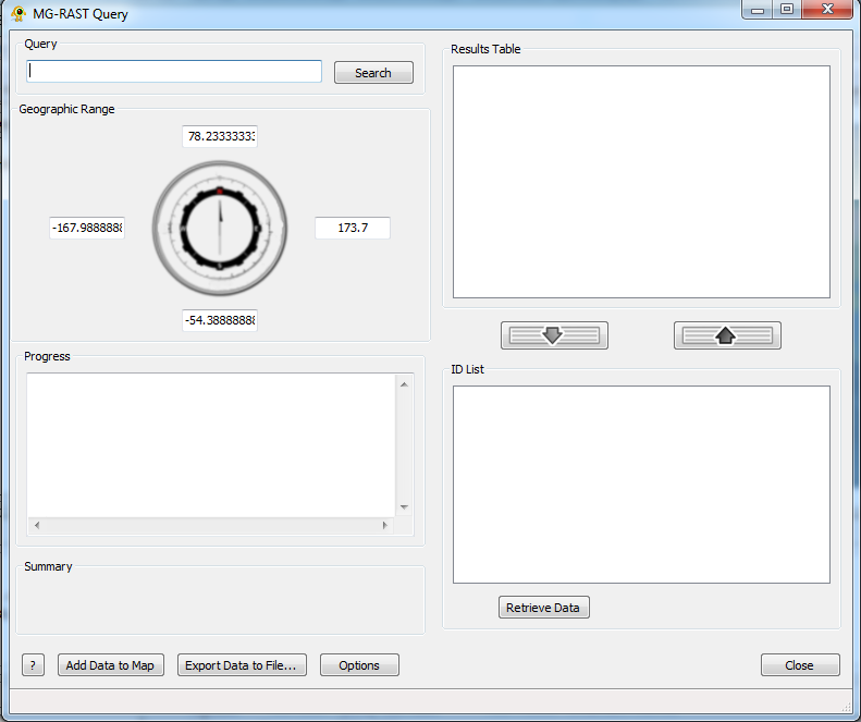
| 10:17, 29 November 2013 | Mgrast1.png (file) |  |
57 KB | Alex | 1 | |
| 10:17, 29 November 2013 | Mgrast2.png (file) |  |
59 KB | Alex | 1 | |
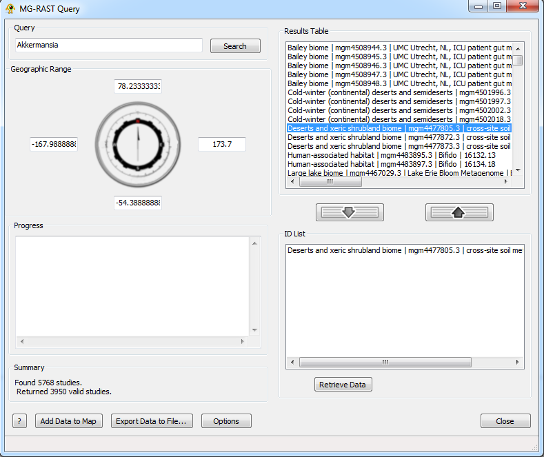
| 10:17, 29 November 2013 | Mgrast3.png (file) |  |
62 KB | Alex | 1 | |
| 10:17, 29 November 2013 | Mgrast4.png (file) |  |
63 KB | Alex | 1 | |
| 10:17, 29 November 2013 | Mgrast5.png (file) |  |
493 KB | Alex | 1 | |
| 10:53, 17 December 2013 | GenGIS V2.20 Windows.zip (file) | 63.79 MB | Alex | 1 | ||
| 10:53, 17 December 2013 | GenGIS v2.20 MacOSX dmg.zip (file) | 157.38 MB | Alex | 1 | ||
| 11:02, 17 December 2013 | GenGIS v2.20 MacOSX .dmg.zip (file) | 157.38 MB | Alex | GenGIS Release v2.2.0 Mac | 1 | |
| 12:11, 25 March 2014 | GenGIS v2.2.1.zip (file) | 66.12 MB | Alex | GenGIS release 2.2.1 | 1 | |
| 12:19, 25 March 2014 | GenGIS v2.2.1 MacOSX.dmg.zip (file) | 162.5 MB | Alex | gengis 2.2.1 Mac | 1 | |
| 13:08, 17 April 2014 | GenGIS v2.2.2 MacOSX.dmg.zip (file) | 159.12 MB | Alex | 1 | ||
| 13:08, 17 April 2014 | GenGIS v2.2.2 Windows.zip (file) | 66.1 MB | Alex | 1 | ||
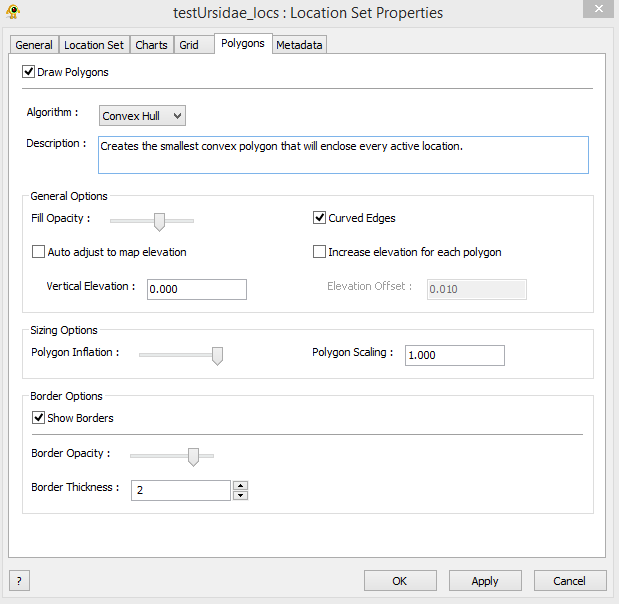
| 13:10, 12 June 2014 | LocationSetProperties Polygons.PNG (file) |  |
20 KB | JustinTrainor | Polygons tab of location set properties window. | 1 |
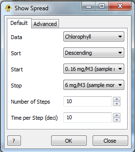
| 11:48, 18 June 2014 | DefaultView.png (file) |  |
26 KB | Alex | default view for show spread | 1 |
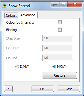
| 11:48, 18 June 2014 | AdvancedView.png (file) |  |
16 KB | Alex | advanced view for show spread | 1 |
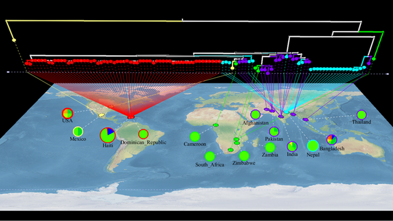
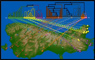
| 08:09, 7 August 2014 | Cholera.png (file) |  |
1.18 MB | Beiko | GenGIS image of Vibrio cholerae dataset showing single-source introduction to Haiti. Data from Katz et al. (2013) http://www.ncbi.nlm.nih.gov/pubmed/23820394 Samples from Nepal are coded in cyan, samples from Haiti are in red. Pie charts show the dis... | 1 |
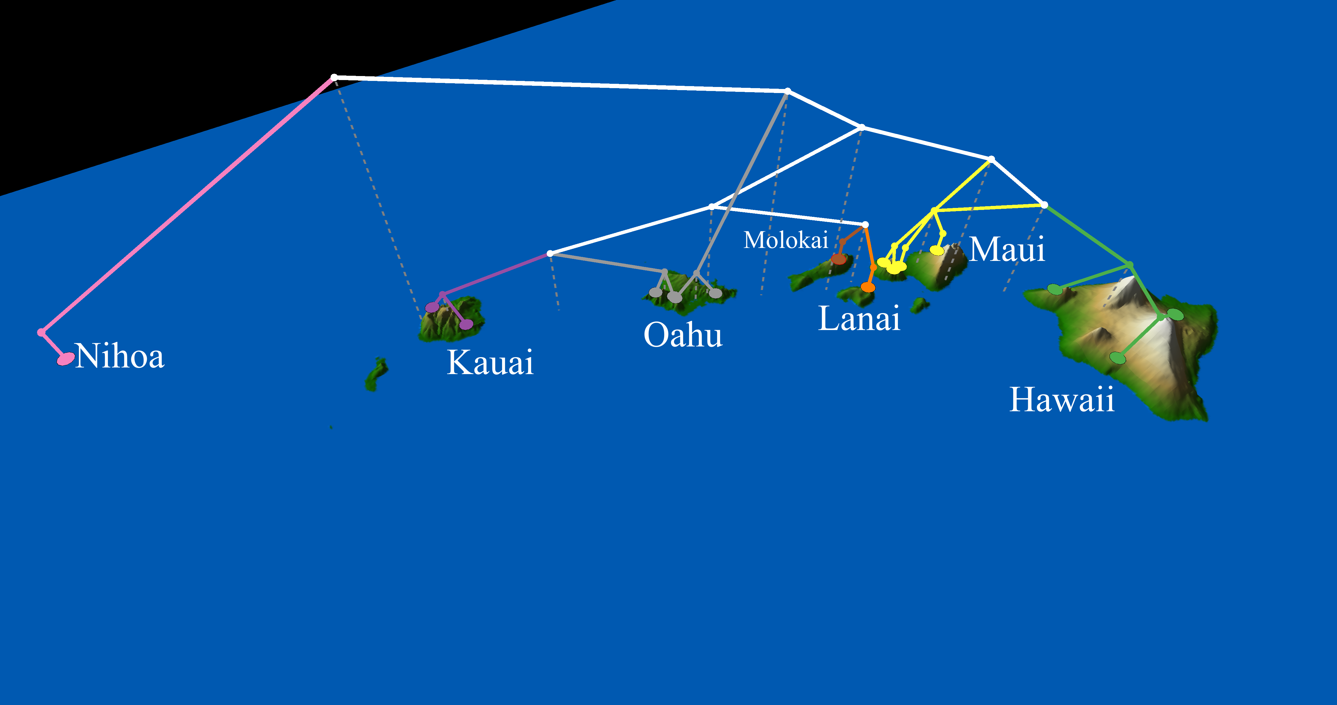
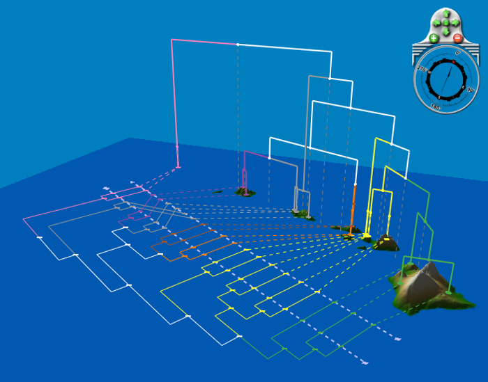
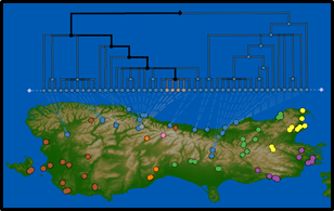
| 08:43, 7 August 2014 | Hawaii.png (file) |  |
561 KB | Beiko | Geophylogeny of Hawaii katydids | 1 |
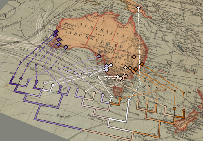
| 13:49, 7 August 2014 | AusOldWorld.png (file) |  |
879 KB | Beiko | Kangaroo apple phylogeny (Poczai et al., 2011: http://www.ncbi.nlm.nih.gov/pubmed/21258867) mapped onto old map of Australia | 1 |
| 13:49, 7 August 2014 | Bio2.0.png (file) |  |
2.41 MB | Beiko | Pilot samples from the Biomonitoring 2.0 project | 1 |
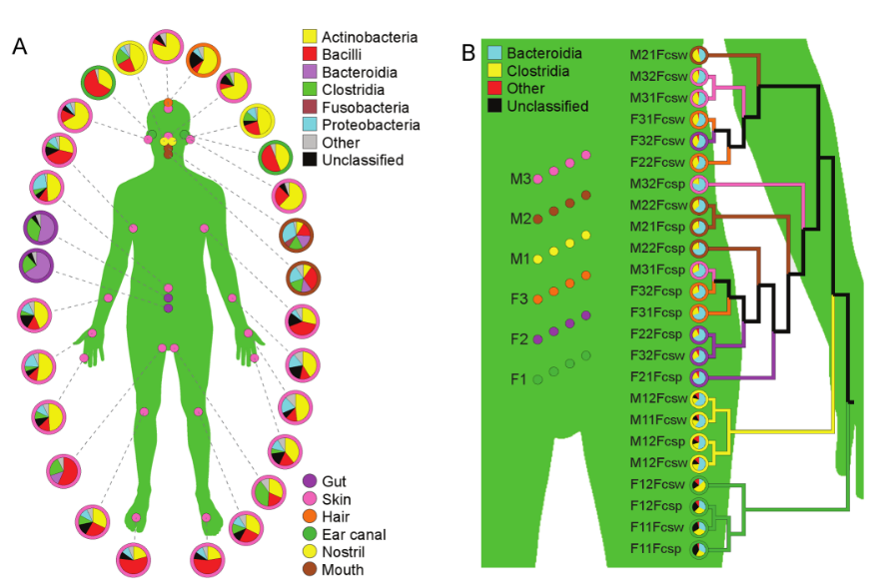
| 13:51, 7 August 2014 | Costello-body.png (file) |  |
317 KB | Beiko | Summary of taxonomic distributions of microbes at different body sites (A), and focused on the gut (B). Data from Costello et al. (2009): http://www.ncbi.nlm.nih.gov/pubmed/19892944 | 1 |
| 13:51, 7 August 2014 | HawaiiKatydids.png (file) |  |
189 KB | Beiko | Another view of Hawai'i katydid phylogeny. | 1 |
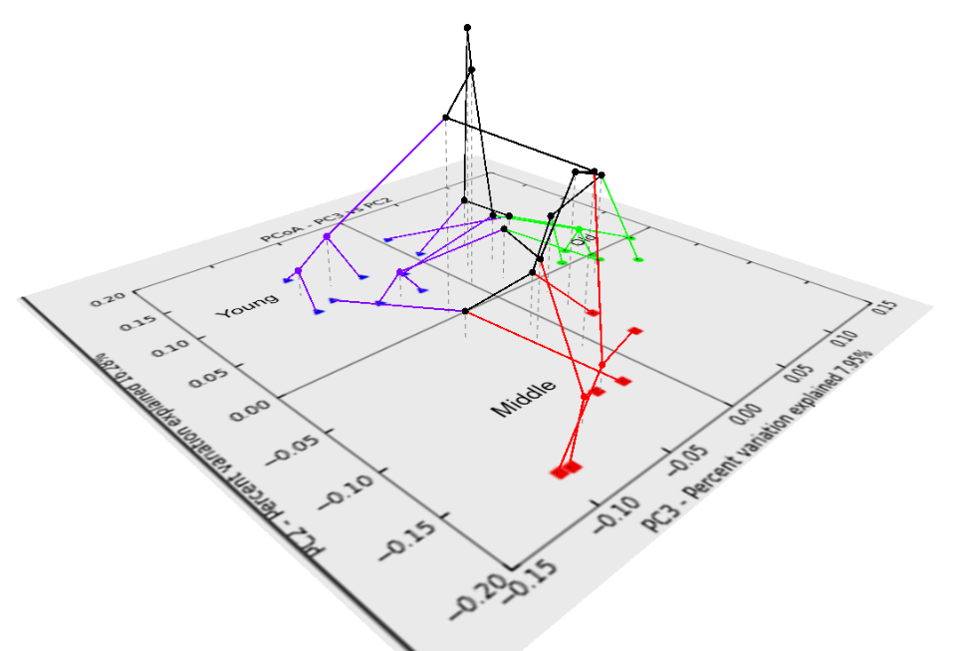
| 13:52, 7 August 2014 | MouseOrdination.png (file) |  |
165 KB | Beiko | Clustering of microbial samples from young, middle aged, and old mice, overlaid on an ordination plot. | 1 |
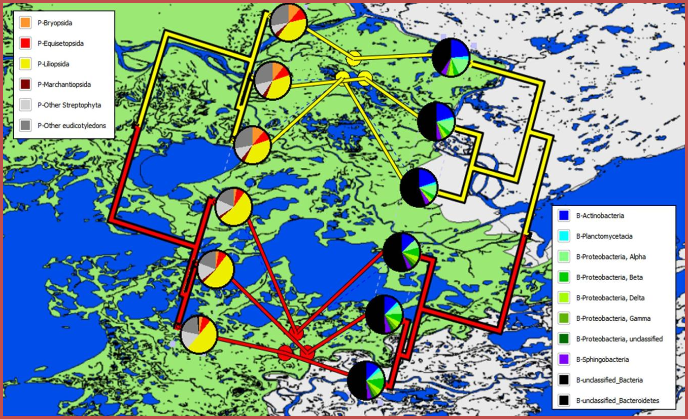
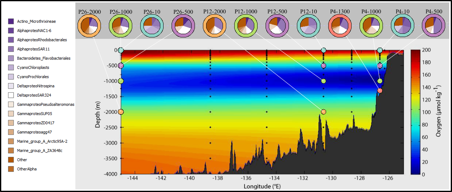
| 13:55, 7 August 2014 | Sup05-1.png (file) |  |
661 KB | Beiko | Taxonomic breakdown of samples by depth and Line-P transect location. Data from Wright et al. (2012): http://www.ncbi.nlm.nih.gov/pubmed/22580367 | 1 |
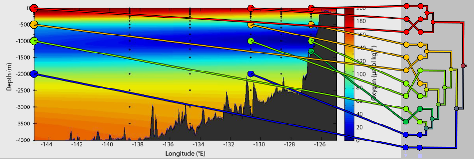
| 13:56, 7 August 2014 | Sup05-2.png (file) |  |
336 KB | Beiko | Clustering of microbial samples (Canberra distance) taken from different depths and locations along the Line-P transect. Data from Wright et al. (2012): http://www.ncbi.nlm.nih.gov/pubmed/22580367 | 1 |
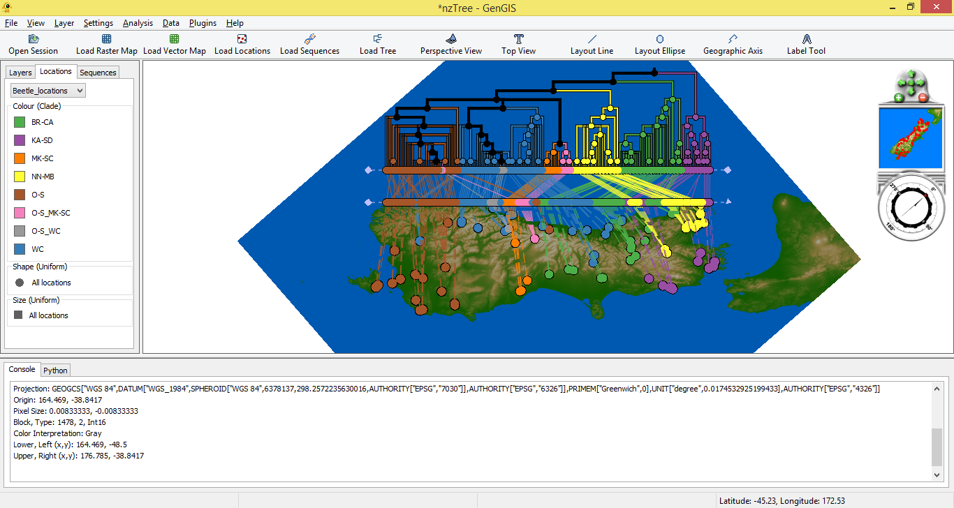
| 13:57, 7 August 2014 | NZ Pic3.png (file) |  |
262 KB | Beiko | Phylogeny of New Zealand beetles, coloured by assigned clade. Data from Marske et al. (2009): http://www.ncbi.nlm.nih.gov/pubmed/19900173 | 1 |
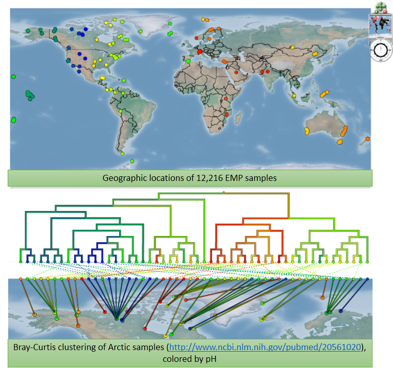
| 13:59, 7 August 2014 | EMP figs.png (file) |  |
701 KB | Beiko | Figures showing all samples available through the Earth Microbiome Project, and clustering of Arctic sites by pH (data from http://www.ncbi.nlm.nih.gov/pubmed/20561020) | 1 |
| 21:56, 7 August 2014 | LachnoMovie x264.mp4 (file) | 6.05 MB | Beiko | Flythrough of different microbial sampling locations, showing the relative abundance of the bacterial family Lachnospiraceae and different environmental types. | 1 | |
| 10:41, 8 August 2014 | GenGIS v2.3.0 Windows.zip (file) | 168.71 MB | Alex | 2 | ||
| 11:00, 8 August 2014 | GenGIS v2.3.0 MacOSX.dmg.zip (file) | 159.4 MB | Alex | 2 | ||
| 15:26, 13 November 2014 | GenGIS v2.4.0 Windows.zip (file) | 171.11 MB | Alex | GenGIS 2.4.0 Release | 1 | |
| 15:54, 13 November 2014 | GenGIS v2.4.0 MacOSX.dmg.zip (file) | 159.56 MB | Alex | GenGIS 2.4.0 Mac Release | 1 | |
| 09:05, 14 November 2014 | Collapse1.png (file) |  |
75 KB | Alex | 1 | |
| 09:05, 14 November 2014 | Collapse2.png (file) |  |
76 KB | Alex | 1 | |
| 09:05, 14 November 2014 | Split1.png (file) |  |
74 KB | Alex | 1 | |
| 09:05, 14 November 2014 | Split2.png (file) |  |
88 KB | Alex | 1 | |
| 09:05, 14 November 2014 | Zoom1.png (file) |  |
80 KB | Alex | 1 | |
| 09:05, 14 November 2014 | Zoom2.png (file) |  |
61 KB | Alex | 1 | |
| 13:54, 27 August 2015 | GenGIS v2.4.1 Windows.zip (file) | 171.04 MB | Alex | 1 | ||
| 14:19, 27 August 2015 | GenGIS v2.4.1 MacOSX.dmg.zip (file) | 159.58 MB | Alex | 1 | ||
| 11:40, 16 February 2016 | GenGIS v2.4.2 Windows.zip (file) | 171.14 MB | Alex | New release of GenGIS | 1 | |
| 11:06, 9 March 2016 | GenGIS v2.5.0 Windows.zip (file) | 172.28 MB | Alex | 2 | ||
| 09:43, 11 April 2016 | Rca tutorial.zip (file) | 278 KB | Alex | 2 | ||
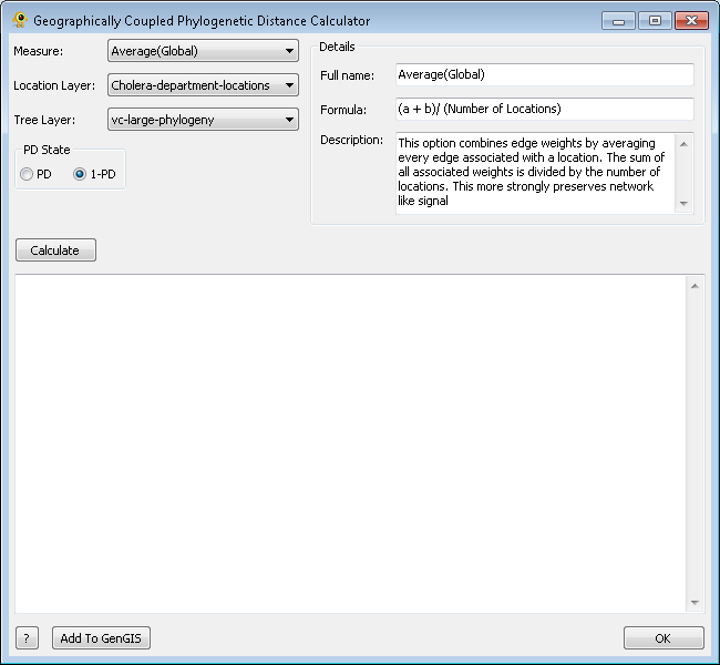
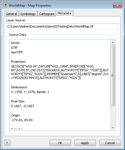
| 12:06, 15 May 2016 | Gcpd1.png (file) |  |
17 KB | Alex | 1 | |
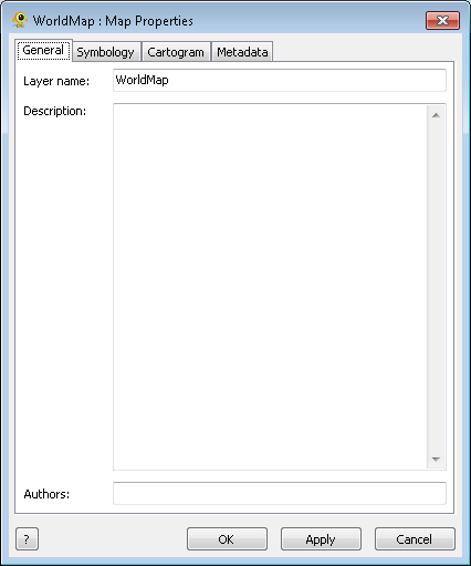
| 12:28, 15 May 2016 | MapLayer1.png (file) |  |
8 KB | Alex | 1 | |
| 12:32, 15 May 2016 | MapLayer2.png (file) |  |
13 KB | Alex | 1 | |
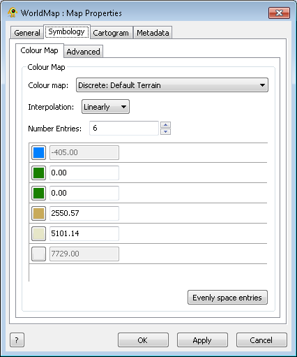
| 12:32, 15 May 2016 | MapLayer22.png (file) |  |
10 KB | Alex | 1 | |
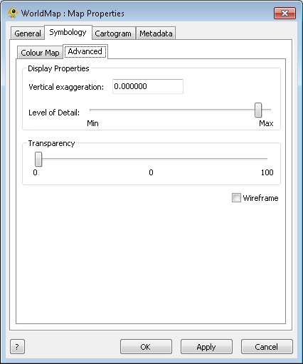
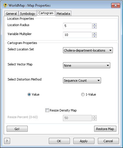
| 12:32, 15 May 2016 | MapLayer3.png (file) |  |
14 KB | Alex | 1 | |
| 12:33, 15 May 2016 | MapLayer4.png (file) |  |
12 KB | Alex | 1 |