File:Sup05-2.png
From The GenGIS wiki
Jump to navigationJump to search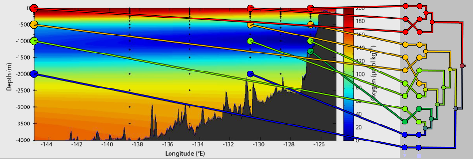
Size of this preview: 799 × 269 pixels. Other resolutions: 320 × 108 pixels | 971 × 327 pixels.
Original file (971 × 327 pixels, file size: 336 KB, MIME type: image/png)
Clustering of microbial samples (Canberra distance) taken from different depths and locations along the Line-P transect. Data from Wright et al. (2012): http://www.ncbi.nlm.nih.gov/pubmed/22580367
File history
Click on a date/time to view the file as it appeared at that time.
| Date/Time | Thumbnail | Dimensions | User | Comment | |
|---|---|---|---|---|---|
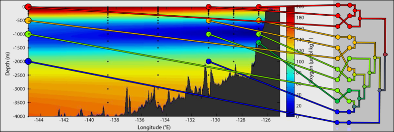
| current | 18:56, 7 August 2014 | 971 × 327 (336 KB) | Beiko (talk | contribs) | Clustering of microbial samples (Canberra distance) taken from different depths and locations along the Line-P transect. Data from Wright et al. (2012): http://www.ncbi.nlm.nih.gov/pubmed/22580367 |
You cannot overwrite this file.
File usage
The following page uses this file: